Our UAV and processing service concerning media, vfx & virtual reality (VR) at a glance:
Logging CGI data records and VFX raw data from the air by means of UAVs and LiDAR scanners on the ground
- Raw data logging from the air and on the ground based on textured (colour) point clouds
- 3D modeling & 3D mesh models – polygon mesh (wireframe models)
- Mesh decimation, retopology, reprojection and UV mapping
- High-resolution textures
- Evaluation of 3D point clouds in the form of 3D CAD modelling
- Photorealistic 3D renderings
Logging and transmitting media-related content from the air with drones
- High-resolution aerial images
- High-resolution videos from the air of cinematic quality (Alexa Mini or RED)
- Video post-processing
- Image processing
Capturing and processing virtual reality (VR) and 360° content using drones and RC VR cars from one source
- 360 degree content from the air by means of flying and stabilised 360-degree rigs
- 360 degree views
- Virtual reality (VR) 360° panoramas / 360° spheres
- Virtual reality (VR) videos in 8K
- Dynamic 360-degree content at eye level through our VR car on the ground
- Virtual tours
- VR stitching / 360-degree stitching
Logging media, VFX and virtual reality (VR) content with drones
With many years of experience in the field of aerial photography, we are the right service provider for creating high-quality film, photo and data material which is best-suited for use in media and virtual reality (VR)-related fields. We deliver digital content for the film, VR (virtual reality) and gaming sector. You receive from us the agreed content in the desired data format in order to use it seamlessly for digital processing.
Logging VFX content and CGI data sets from the air with UAVs and LiDAR scanners on the ground
It is not just in the motion picture industry that CGI (Computer-Generated Imagery) is increasingly gaining in popularity. many other sectors of industry, such as social media, are discovering the variety of application options for themselves. The visible boundaries between image material actually captured and subsequently inserted animations are increasingly disappearing. In addition to ever-advancing processing capabilities, this is also down to the constantly improving quality of the data material supplied. We record the exact terrain areas and surfaces which you require for your post-production in order to reduce your workload at the location.
For the recording of landscapes, buildings and enclosed spaces, we use photogrammetric processes combined with our copters, but also UAV laser scanners (LiDAR scanners), as well as terrestrial laser scanners on the ground (especially indoors for low ceiling heights). We then take on the evaluation of raw data and prepare the data records for digital processing so that VFX or CGI content can be created from it.
VFX – Visual Effects
The field of visual effects is becoming increasingly important in film productions. Here drones can be effectively used to capture 3D data, images and video footage to save time, personal and costs.
Gaming
The gaming industry has become a multi-billion-dollar element of the entertainment industry. Following consultation, we deliver required data, such as large-scale, high-resolution textures, which are acquired using our drones. The capturing of background plates, terrain scans, point clouds and 360°SkyBoxes is effortlessly possible from the air. Drones are mobile and can be deployed in a highly flexible manner to capture large surface areas in the shortest possible time. Recording takes place in a contact-free way using cameras or laser scanners. A combination of aerial and ground-based images, such as terrestrial laser scans (LiDAR), is possible.
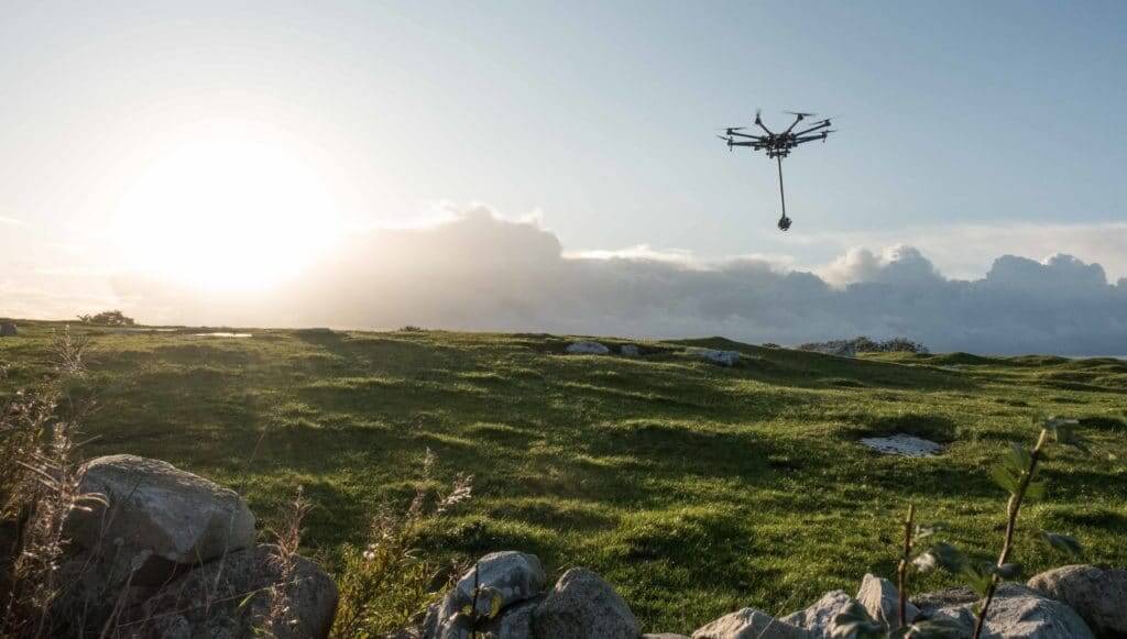
High-resolution aerial images
High-resolution aerial images taken with our high-tech drones are ideal for marketing purposes, presentations and many other fields of application. Through discussions held in advance, we can narrow down the exact type of pictures you require for your purposes – different angles, flight altitudes, qualities and precisely reproduced flights (GPS-supported) for multiple or later points in time pose no problem at all. We fly outdoors, but also in concealed spaces, in buildings, and underground, such as in tunnels. We therefore offer flexible solutions fully within the limits of your budget
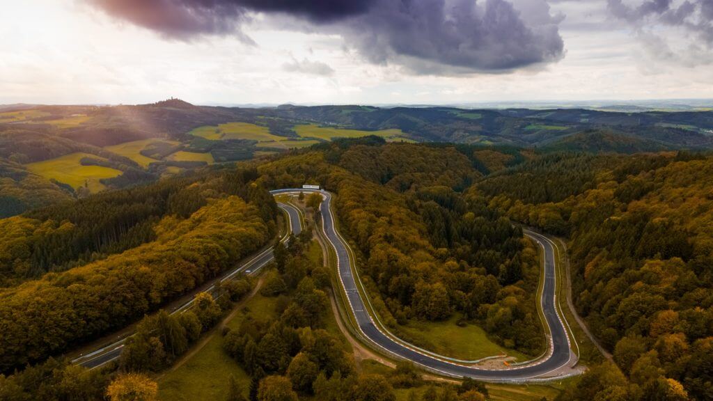
High-resolution videos from the air
We deliver mesmerising moving images of the highest quality with our camera drones. We use different camera drones specific to each application and requirement, from budget-conserving complete systems (single or dual operator) right through to the latest cinematic cameras, such as Alexa Mini or RED.
With our in-house label Skynamic, everything revolves around the optimum planning and implementation of aesthetically appealing, high-end aerial recordings in Full HD – 8K.
You are currently viewing a placeholder content from Vimeo. To access the actual content, click the button below. Please note that doing so will share data with third-party providers.
360° content from the air for media & virtual reality (VR) use
In the constantly growing virtual reality (VR) sector, UAVs are available for obtaining the necessary data material (e.g. 360° panoramas or point clouds). Within the shortest possible time, a wide range of image, video and data material can be obtained in a cost-efficient manner. In addition to 360° panoramas, virtual tours and all-round vision, VR technologies also enable a wide range of application opportunities in the entertainment industry. Active media & virtual reality (VR) is creating unique experiences in social media and advertising.

Moving HD video, virtual reality (VR) and 360° images at ground level
With our RC rovers, we create stable and dynamic videos and/or 360° VR images at ground level. The quick, agile and remotely controlled all 4-wheel-drive vehicle enables the following equipment: 360° VR rig or 360° camera, as well as camera gimbals for all common cameras, but above all for the Alexa Mini camera, as well as RED cameras or various LiDAR scanners.
The off-road capability, size and speed of up to 80 km/h offers the possibility of following objects or reaching areas that are accessible to humans only with great difficulty, or perhaps even not at all. Stable camera travel over long distances (especially in the narrowest of space) is possible without any issues and, thanks to the electric drive, the noise level is low and not disturbing.
Location scouting, recce and decision-making
UAVs provide you with the possibility of depicting a location or geographic area virtually and without high personnel costs. With the aid of photogrammetry and 3D laser scanning (LiDAR), 3D point clouds, 3D models and 2D orthomosaic photos (orthophotos) can be created in a way which is up to date and true to detail. 360°/VR photos and videos can also help you to assess an area in advance from every point of the ground. This method of virtual location scouting is efficient, cost-saving and brings with it the data foundations for 3D programs and CAD software for planning, calculations and outlining.
Besides media & virtual reality (VR) conten you can find the various drone services HERE
We would be delighted to provide you with a tailored and non-binding offer. Please feel free to use our PROJECT QUERY page to submit a query.