UAV photogrammetry and UAV laser scanning (LiDAR scanning) compared
Comparison of the logging methods UAV photogrammetry and UAV laser scanning
Choosing the technology and method for gathering data should be based on pre-defined requirements. Both methods have different advantages and limitations depending on the application. The methods fundamentally differ in terms of point density, accuracy, the complexity of post-processing and in the options for evaluating processed point clouds afterwards. The speed of gathering is just as quick in both methods.
Depending on the result desired, we choose between the traditional photogrammetry method using RGB cameras or LiDAR (light detection and ranging) scanning. Laser scanners work according to the same principle as radars but with the light of a laser used for measurement.
Using a textured (coloured) point cloud, aerial image photogrammetry allows for the actual condition of surfaces, structures and assets/inventories to be depicted in 3D. This method depends on good light conditions. In contrast with RGB cameras, LiDAR scanners do not depend on light conditions, but they do have difficulties with very dark or highly reflective surfaces. On top of all this, LiDAR scanning hardware is currently much more expensive.
The two methods UAV photogrammetry and UAV laser scanning (LiDAR) can essentially be summarised as follows:
UAV photogrammetry:
With UAV photogrammetry, a point cloud is processed from a large number of high-resolution images by means of a high level of computational power, resulting in a highly dense, realistic and textured point cloud.
UAV laser scanning (LiDAR scanning):
The LiDAR scanner is characterised by a high level of precision (in terms of elevation, Z-axis) as well as a very short post-processing time. The point cloud is currently smaller than for photogrammetry and it is often colourless. The unique selling point of a LiDAR scanner is the ability to cut through vegetation in order to capture and depict the surface underneath. Since UAVs fly lower and slower than LiDAR aeroplanes and helicopters, you obtain higher point density and better classification with UAV LiDAR scanning.
When photogrammetry and LiDAR (laser scanning) are juxtaposed, the focus is frequently on precision. Ultimately, the customer or user has to know which levels of accuracy are to be achieved. LiDAR scanning gives users the option of gaining somewhat in precision, but it is also difficult to obtain a high resolution (point density) from LiDAR data from the air.
It is about choosing the right tool for the respective project – UAV photogrammetry and UAV LiDAR scanning according to the application
UAV photogrammetry:
- Creating distortion-free aerial images – (georeferenced) orthomosaic photos
- Creating digital surface models (DSM)
- Creating colour 3D models / textured meshes (3D renderings)
- Creating documentation and realistic images of actual conditions
- Creating detail-rich panoramas and views
UAV laser scanning:
- Creating digital terrain models (DTM) – earth’s surface without vegetation
- Recording vegetation – mapping, inventory recording and biomass determination
- Gathering data/measurement points in difficult light conditions (shadows)
- Logging long distances (e.g. corridor mapping)
- Recording fine objects or infrastructure (high-voltage lines, pipes)
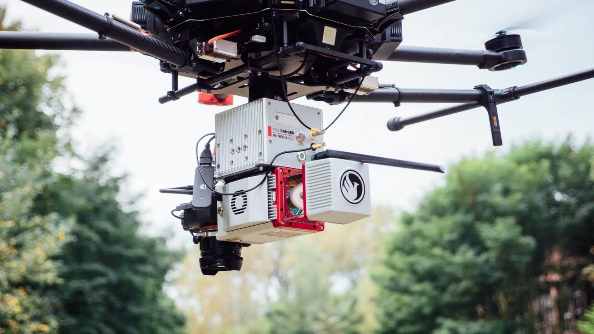
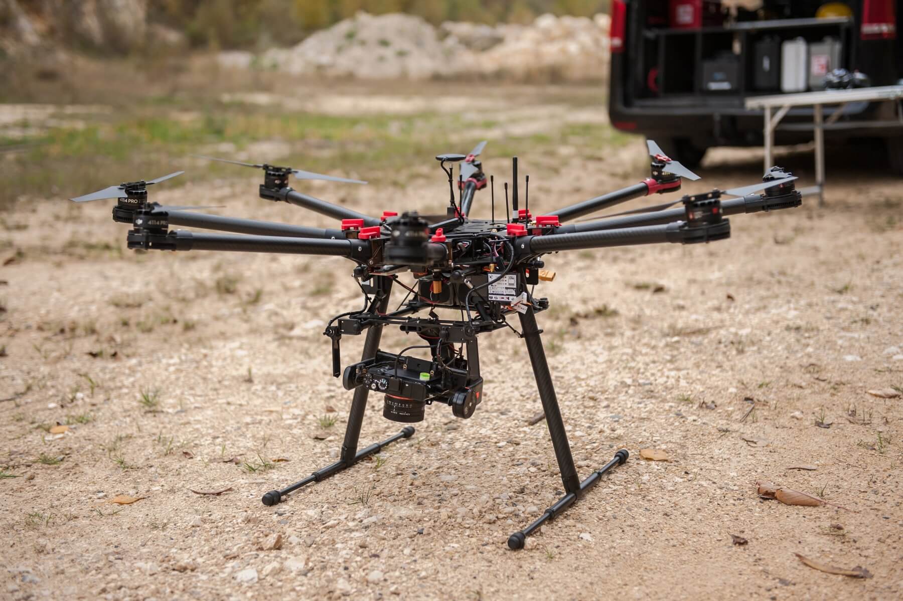
Examples of UAV photogrammetry and UAV laser scanning hardware: