UAV LiDAR Surveying – Airborne Laser Scanning by Drone
LOGXON specialises in UAV LiDAR surveying. We deliver precise 3D survey results and ready-made geo data as per your specifications in your preferred data format. In order to meet our customers’ high quality demands, we exclusively use the powerful systems of renown manufacturer RIEGL for drone terrain surveys.
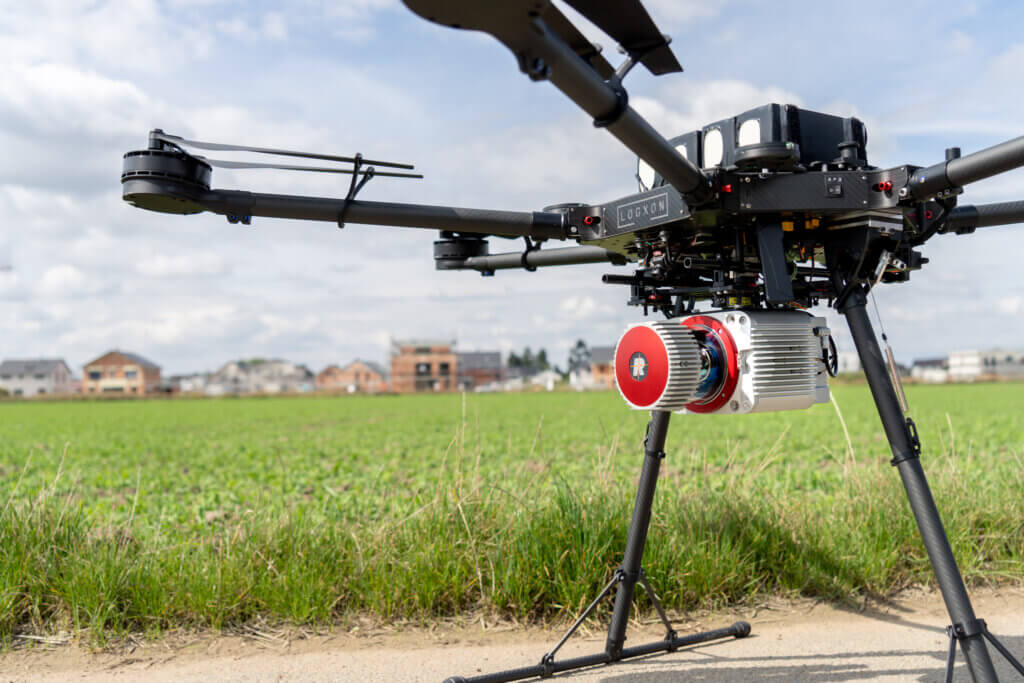
Our PORTER drones enable the safe use of airborne laser scanning systems, consisting of a higly precise LiDAR sensor, survey-grade GNSS/IMU for direct geo-referencing and a high-resolution survey photograph camera (nadir or dual setup). Our potent surveying system is not only very accurate, but also excels in high point density. Another plus is its reliable penetration of vegetation for 3D terrain surveys under difficult conditions.
REQUEST FREE CUSTOMISED OFFER NOW
Drone surveying using airborne laser scanning sensor
For UAV LiDAR surveying, we use airborne laser scanning systems, mainly the RIEGL VUX-1 UAV system, whose full wave sensor was originally developed for manned aerial vehicles, in particular helicopters. This laser scanner is very precise, compact and lightweight enough to survey any areas including objects by drone in no time at all. It is also easily capable of photographing complex or inaccessible areas. The result? Homogenous high-quality survey data for any terrain.
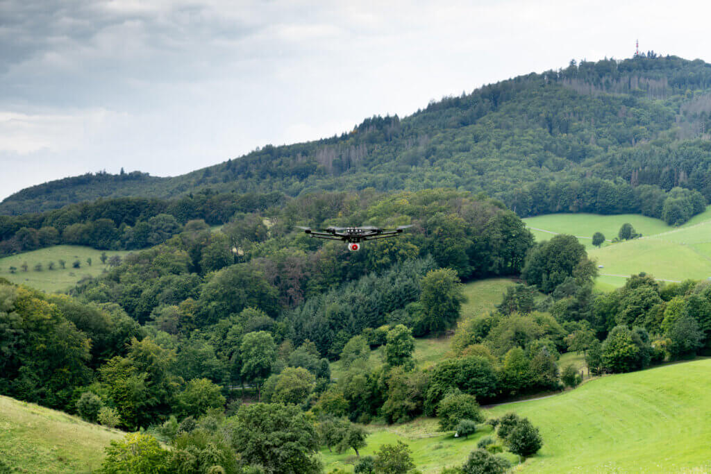
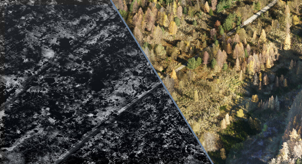
Another plus of the LiDAR technology is its reliable penetration of vegetation, leaves and treetops for terrain surveys and to create digital terrain models. A thin laser beam makes use of the smallest gaps to capture the ground surface along with the vegetation it covers. Analysing the (unlimited) echo for each laser pulse, also called multi-target surveys, enables precise filtering and ranking of the point cloud. In contrast to photogrammetric surveying, the terrain surface is actively surveyed instead of derived from photographs.
The strengths of our potent surveying system at a glance:
- Precise surveying at high resolutions of areas, corridors/routes and objects
- Penetration of vegetation under very difficult conditions
- Direct geo-referencing using survey-grade GNSS and precise IMU
- Area: 250 ha/day thanks to high surveying speeds and reach
- 500,000 multi-target surveys per second at 550kHz and 330° field of view (FOV)
- Single-camera system (nadir) to create orthophotos and to colour in the point cloud
- Dual-camera system to precisely colour in the point cloud up to approx. 160° (FOV)
- Result after analysis: ranked geo-referenced point cloud in greyscale or colour
FIND OUT MORE IN A PERSONAL CONVERSATION
We can deliver the following results based on UAV LiDAR surveying in a pre-determined output format:
- Dense geo-referenced and ranked point clouds
- Digital terrain models with high point density in various versions
- Digital elevation models (DEMs)
- Digital terrain models (DTMs)
- Digital surface models (DSMs)
- Processing digital terrain models
- Creating break lines, isolines (contour lines)
- Elevation grid
- Analysing digital terrain models
- Creating terrain profiles and/or elevation maps
- Volume calculations for quantity surveying
- Monitoring slope movements
- Documenting material and object settlement/subsidence
- Delta and target-actual comparisons
- Inclination analysis
- Digital urban models, landscape and building models in various levels of detail (LoD)
- 3D models (3D CAD models)
- 2D maps
For a detailed overview of our ready-made results, please visit Digital terrain models, elevation models and surface models with high point density
START YOUR FIRST UAV LiDAR SURVEY NOW
Summary of our competencies in airborne laser scanning:
- Results-focused consultation about surveying method, usage options and processing
- Use of cutting-edge technology—precise high-resolution scanners and cameras
- Precise geo data and ready-made models with freely selectable level of detail
- Smooth collection and customised analyses for a high level of customer satisfaction
- Valuable UAV experience, field-proven over many years
- Specially qualified staff for data analysis
- Compelling value for money
CLICK HERE TO PERFORM YOUR UAV LiDAR SURVEY WITH US
For general information and further UAV-ready LiDAR systems, please visit UAV laser scanning (LiDAR) and UAV photogrammetry and UAV laser scanning (LiDAR).