Our drone services in the field of monument preservation and the digitalisation of cultural property:
Contact-free 3D surveying, digital condition scanning and three-dimensional documentation
- 3D surveying with a drone using drone photogrammetry and drone laser scanning in the field of monument preservation
- Condition scanning and three-dimensional documentation with a drone for the digitisation of cultural property
- Stone-by-stone measurement of façades by means of drone photogrammetry using high-resolution and calibrated camera systems or LiDAR scanners
- True-to-scale and high-resolution façade documentation with drone photogrammetry
- 3D measurement, 3D surveying and digital condition scanning (in greyscale or colour) using terrestrial laser scanners
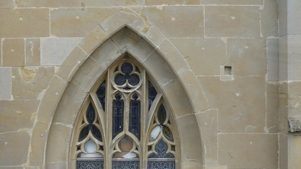
- Contact-free scanning of listed buildings and their frameworks, annexes, stuccoes, ornaments, windows and doors
- Condition scanning by means of drone photogrammetry and terrestrial photogrammetry in combination with terrestrial laser scanning in colour
- High-resolution 3D scans of relics with or without texture for the digitisation of cultural property
- Fast and cost-effective 3D condition scanning by means of mobile laser scanning

Photogrammetric image processing and processing of 3D laser scans
- Photogrammetric image processing and processing of textural point clouds
- Recording and processing of point clouds from drone and terrestrial laser scans
- Simultaneous recording and processing of photogrammetric and LiDAR (laser scanning) raw data
- Georeferenced orthomosaic photos of a historical condition in a wide variety of scales and resolutions
- High-resolution façade views in the form of orthomosaic photos (rectified survey photographs) as a basis for planning and damage mapping.
- Digital elevation models (DEM), digital terrain models (DTM) and digital surface models (DSM)
- Analysis: determining evenness, subsidence or deformations and deformities
- Processing curved areas
3D modelling (CAD models), 2D plan creation (CAD plans) and façade drawings
- 2D plans: as-built plans, floor plans (with/without orthomosaic photos), sections (longitudinal sections and cross sections), views and façade plans
- True-to-scale façade drawings: line drawings and aerial mosaics (façade drawings including orthomosaic photos)
- 3D models (3D CAD models) of historical buildings and entire historical complexes


Digitisation, 3D visualisation and 3D modelling (textured wireframe models) of monuments and cultural property
- Visual condition scanning, surveying and archiving by means of 3D scanning (photogrammetry and/or laser scanner)
- High-resolution 3D town models and planning models of historical old towns, groups of buildings, entire historical complexes and ancient sites
- High-resolution 3D models of archaeological monument and heritage areas
- High-resolution 3D models of architectural monuments for digital tours, Web/virtual reality applications and publicity work
- High-resolution 3D models of technical monuments complex free-form objects, such as sculptures, stuccoes, etc.
- Volumetric 3D mesh models with or without texture for precise and/or photorealistic reconstruction and restoration
- 3D mesh models with high-resolution textures for damage mapping
- 3D visualisation and photorealistic renderings
Visual documentation and monitoring
- High-resolution aerial images for the visual documentation of actual conditions, as well as progress and damage documentation
- Visual inspection by means of HD live-image transmission and recording
- Images/panoramas as a background for 3D renderings and visualisations
- 360-degree content (image/video) captured by means of a stabilised 360-degree rig or full-format camera using a drone
- Dynamic 360-degree content at eye level through our VR car on the ground
- 360-degree virtual tours and presentations
- Aerial images and videos for marketing, sales and publicity work
3D surveying and processing in the field of monument preservation
In the field of monument care and preservation, we confront special challenges. Not only do we have the task of scanning architectural monuments, historical old towns, groups of buildings and entire historical complexes, always in full and with high resolution, we also have the duty of meeting the very high accuracy requirements of monument preservation and of our demanding and quality-focussed customers.
Textured point cloud section from photogrammetric recordings using a drone
The basis for a renovation and reconstruction of historical buildings is a precise planning basis. This also applies to (damage) documentation in the field of monument care and preservation. In addition to digital as-built plans and building sections, this also includes true-to-scale and high-resolution façades views.
We survey complex buildings, digitise historical conditions and document the actual condition both three-dimensionally and in the form of high-resolution survey photographs. In this process, we always make use of the latest technical equipment such as industry drones form our own factory, calibrated cameras, high-end workstations, GPS rovers, tachymeters and of course 3D laser scanners.

Results of a 3D survey and documentation in the field of monument preservation
We calculate 3D point clouds from the raw data collected. The point cloud is already the result of a 3D measurement or three-dimensional condition scanning. The high density of the point cloud enables the depiction of complex objects such as surface structures.
Dimensions can be deduced, paths measured and surfaces formed from the point cloud. Additional results can also be derived, such as georeferenced orthomosaic photos, façade views and 3D terrain models, as well as elevation models. For CAD modelling, the point cloud is used as a basis for design in order to create 3D models, as-built plans, floor plans (with/without orthomosaic photos), sections (longitudinal sections and cross sections), views and façade plans
Digitisation of cultural property
The trend toward digitalisation can be felt in nearly all sectors of the economy, and the digitisation of cultural property is a service in greater demand than every before. On the one hand, this involves the scanning, documenting, cataloguing and archiving of valuable cultural property, historical buildings, monuments and complex free-form objects. The collected and processed digital data also forms the basis for the planning of renovation measures and for reconstruction.

On the other hand, the extremely detail-rich 3D scans with high-resolution textures are ideal for use in transforming cultural property into the virtual world. For example, once a historic district or listed object is scanned correctly, three-dimensionally and in colour, then it exists in digital format and can be used in an unfathomable variety of ways. The current condition is secured after the scan and can be preserved for eternity. The further processing of 3D data can be performed at any point in time in the future.

We make the collected 3D data records come alive digitally. Through various steps, the geometric information and visual content is turned into photorealistic and interactive 3D models, based on the desired level of detail, the medium and reproducing device. In this process, constructed (CAD) models – such as planned new constructions – can be embedded within the photorealistic surroundings of an existing historical building.
In virtual reality, augmented reality and also on the Internet on a website (3D Web viewer in a browser), impressive tours, panoramic views and experiences can be provided in a virtual but also highly realistic world.
Our areas of expertise in 3D surveying in the field of monument preservation and the digitisation of cultural property
- 3D Surveying of Churches with a Drone, Terrestrial Photogrammetry and Laser Scanning
- 3D Surveying of Castles with a Drone Using Photogrammetry and 3D Laser Scans
- Surveying of Historical Buildings, Industrial Buildings and Castles with 3D Scans
YOU CAN FIND THE INDIVIDUAL DRONE SERVICES HERE
We want to devise the best and most economical solution for your problem together with you. Take a look at our services for yourself now!
We would very much look forward to offering you a customised and non-binding offer. Feel free to use our request page PROJECT REQUEST, to write us an email to info@logxon.com, or to call us using the number +49 6257 504 9011.